Land Snails
.jpg)
.jpg)
.jpg)
Photo(s): Views of a Paravitrea multidentata shell, © Jeff Nekola. Note the somewhat pentagonal profile, and teeth series visible through the base of the shell.
Click photo(s) to enlarge.
Paravitrea multidentata (A. Binney, 1840)
Family: Pristilomatidae
Common name: Dentate Supercoil
Identification
Width: 3.5 mm
Height: 2.5 mm
Whorls: 6+
Paravitrea multidentata can usually be recognized by its very tight, regular coils and angled shell – the side view is like a pentagon. In the hand, fresh shells often appear to have a deeper reddish-gold color compared to other small supercoils and glyphs. The umbilicus is open but very small, and the lip of the aperture is thin.
This animal takes its scientific name from the two or three rows of tiny teeth (4-5 teeth per row) found inside the final whorl. These teeth are in sets that are arranged radially and slightly curved. They can often be seen through the base of the partly-transparent shell. Sometimes solid lamellae are present instead of teeth.
Ecology
Paravitrea multidentata may be found in rocky forests (Nekola, 2009), buried deep inside moist leaf litter (Hubricht, 1985). It has been reported from caves in Tennessee (Lewis, 2005). It is a cooler climate animal known from higher latitude forests.
Taxonomy
Synonyms for P. multidentata include Gastrodonta multidentata, G. m. umbilicaris, Helix multidentata, Hyalina multidentata, Paravitrea multidentata lamellata, P. (Paravitreops) lamellidens, P. (P.) multidentata, and P. (P.) m. lamellata.
Distribution
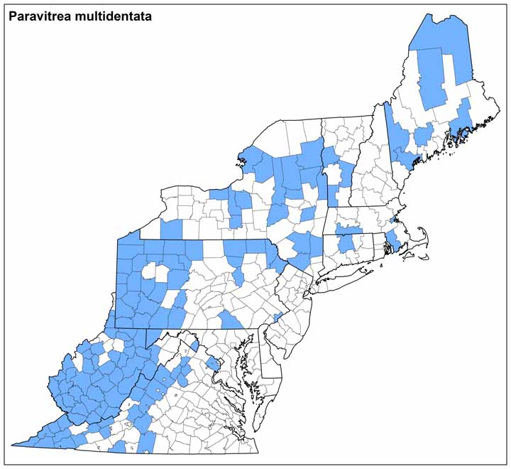
Paravitrea multidentata occurs in southern Canada, the Great Lakes and New England, extending south in the interior and mountains to northern Mississippi and the Ozark mountains. In Virginia it is reported from many of the north interior and western counties.
Conservation
NatureServe Global Rank: G5
NatureServe State Rank: SNR
Ken Hotopp, Meegan Winslow 11/2012
Range Map (click to enlarge)


